A Report by Darren Stone
In 2017 in Tilty, Essex, we still have two woods that I believe fit the established definition of being classed as ancient woodland. Ancient woodland is defined as woodland that has existed continuously since 1600 or before in England. Planting of new woodland before 1600 was uncommon, so a wood present in 1600 was likely to have developed naturally.
These survivors are not common in Essex as just over 5% of the county is woodland cover making it the second least wooded county in England (source: http://www.essexbiodiversity.org.uk/species-and-habitats/ancient-woodland).
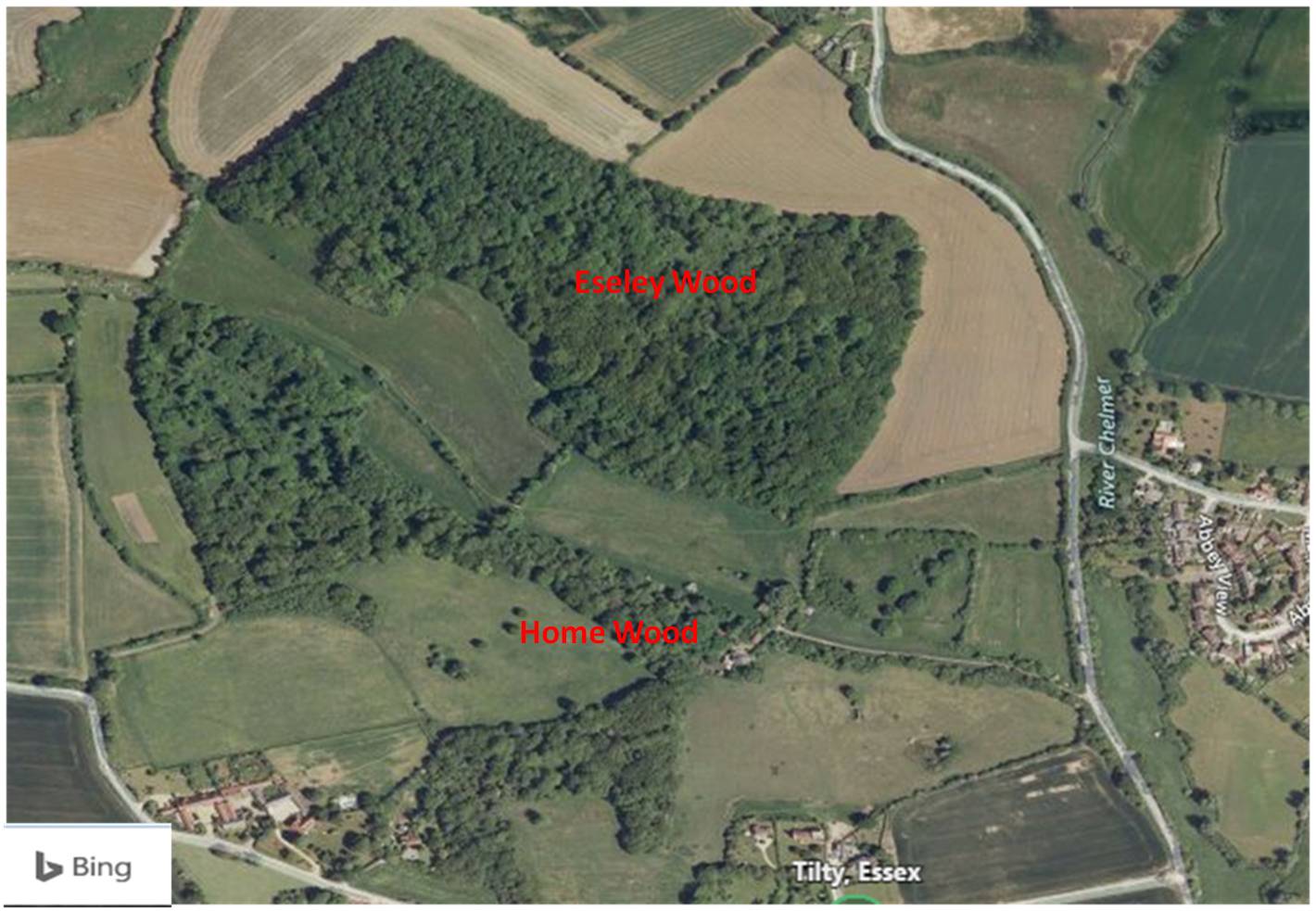
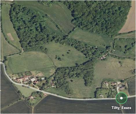
The two surviving woods are Home Wood and Eseley Wood shown below (from Bing maps at https://www.bing.com/maps ). A third wood, Maze Wood, (Between Tilty and Great Easton), survived until the 1960s when it was destroyed.
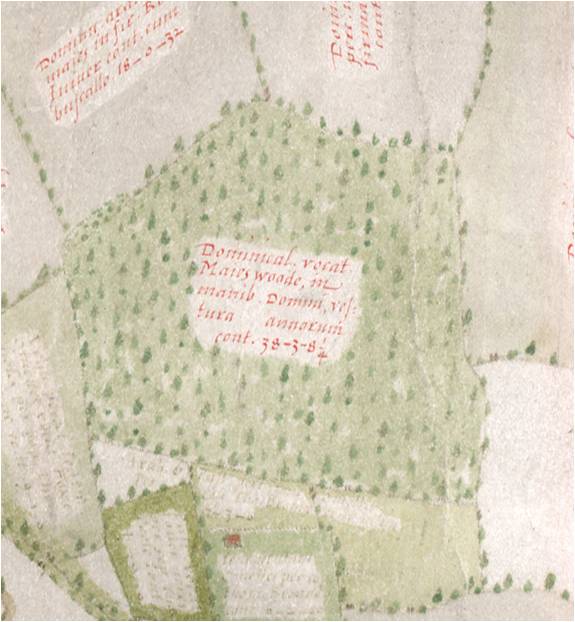
The recorded history of Home Wood and Eseley Wood can be traced back to an Easton Lodge estate map, made in1594, and now in the Essex Record Office (ERO) in Chelmsford.
The map is known as the Agas map, named after the surveyor Ralph Agas who was the best cartographer of his day. The map was commissioned by Sir Henry Maynard who was granted the manor of ‘Estaines’ (Eastons) in 1590, it is believed, as a reward for his service as private secretary to William Cecil, Elizabeth I’s Lord Treasurer. The original map was once thought lost, but is now in the safe keeping of the ERO.
Its ERO reference is D/DMg P25 (and it can be viewed on line via the ERO’s website). Maynard had the map made up to show his lands and the surrounding lands and in 1594 it showed three woods in the Tilty Area: Home Wood, Esall or Eseley Wood and Maze Wood.
These woods and others on the Maynard Easton Lodge Estate were working woods over the 300 year history of the Easton Lodge Estate, (and probably before this there would have been woodlands belonging to the Tilty Abbey estate, founded in 1153).
Item Ref. D/F 35/3/153 – Reproduced by courtesy of the Essex Record Office
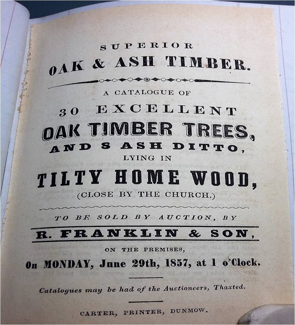
Auctioneers records’ in the Essex Record Office show timber sales from Home Wood, Eseley Wood and Maze wood from 1799 to the 1900s, like this sale catalogue from 1857:
In 1919, after years of deepening financial trouble, and a fire in February 1918, the Easton Lodge Estate was sold off and the woods along with it.
Home Wood, Eseley Wood and Maze Wood all survived the Second World War, when more than a hundred airfields were built in Eastern England in the middle stage of the War. Their construction brought about a transformation of the landscape, and was the main cause of loss of ancient woodland between 1870 and 1945. Easton Lodge itself became one of these airfields with some 10,000 trees, and over 200 mature oaks, being blown up and bulldozed to make way for an airfield that only lasted operationally from July 1943 to 1948.
Home Wood Tilty
This wood currently runs from behind Tilty Mill, along the millpond and up to Tilty Grange. The wood is shown on the Agas map of 1594, see below:
Agas map detail 1594.
Reproduced by courtesy of the Essex Record Office (Ref. ERO D/Dmg P25)
It is also clearly shown on the 1730 Easton Lodge Estate map below:
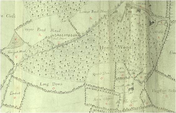
Easton Lodge Estate map detail.
Reproduced by courtesy of the Essex Record Office (Ref. ERO D/DMg P1/1)
The wonderfully detailed 1876 ordnance survey map, (probably the most detailed ever produced), shows no change to the footprint of the wood from the above map. A good place to view this map online is at the National Library of Scotland website: http://maps.nls.uk/index.html
There seems to have been no change until the 1970 version of the OS map when Home Wood is shown as being severely thinned out to its present state as below (Bing maps, 2016 view). Can anybody date this change and say why so much timber was felled? Please get in touch if you have any information about this. Interestingly some scrub appears to be growing up around the edges of the wood, and eventually scrub will form woodland so perhaps nature is slowly reclaiming some of the previous woodland area.
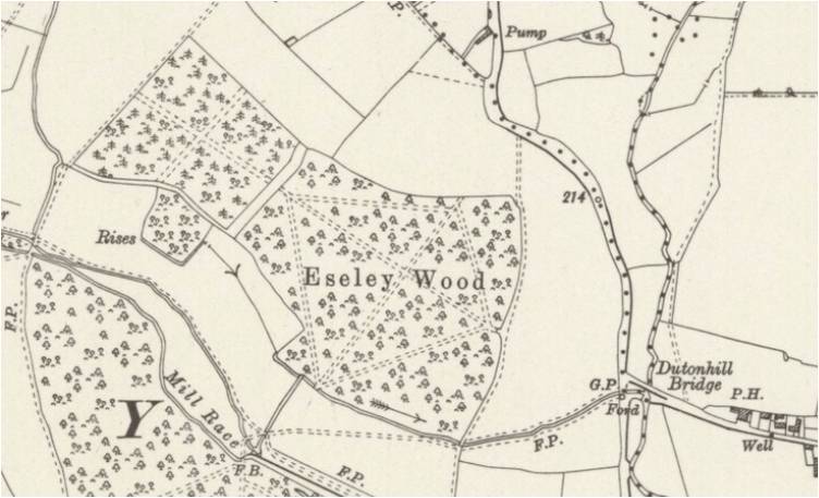
Eseley Wood
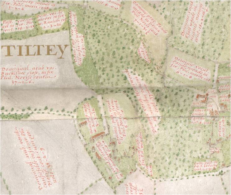
On the Agas map of 1594 Eseley wood is called ‘Esall Wood’
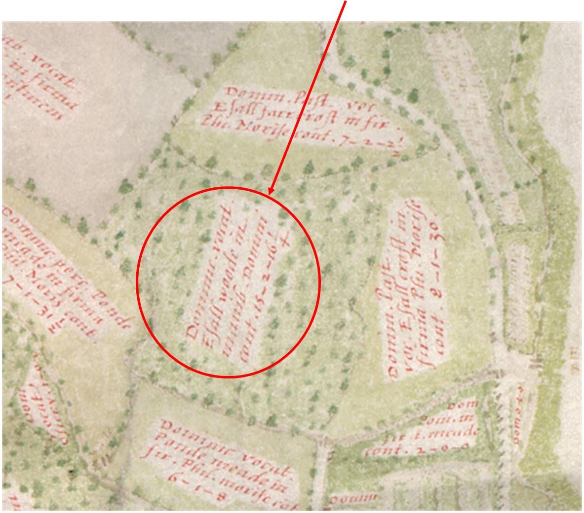
Agas map detail 1594.
Reproduced by courtesy of the Essex Record Office (Ref. ERO D/Dmg P25)
On the 1730 estate map it is called Esley Wood:
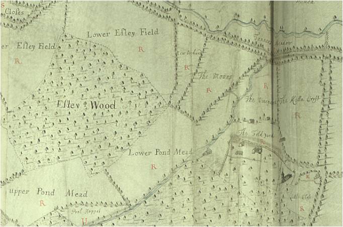
Easton Lodge Estate map detail.
Reproduced by courtesy of the Essex Record Office (Ref. ERO D/DMg P1/1)
On the 1876 OS map its is called Eseley Wood and is shown with clear paths or rides through it (images from National Library of Scotland, Map Images Website: http://maps.nls.uk/index.html )
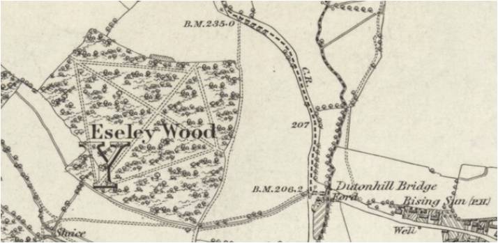
Reproduced with the permission of the National Library of Scotland.
This map can also be viewed here: http://maps.nls.uk/view/102341861#zoom=5&lat=9800&lon=11742&layers=BT
Nothing changes until the 1920 edition (remember the Easton Lodge estate lands were sold in 1919). A field to the NW of Eseley Wood is suddenly forested with what seems to be a newly created conifer plantation, see below:
Reproduced with the permission of the National Library of Scotland:
This map can also be viewed here: http://maps.nls.uk/view/102342140#zoom=5&lat=4830&lon=7449&layers=BT
Who were the new owners of the wood and why did they decide to extend the wood? Any information would be appreciated.
To this day the outline of Eseley Wood remains almost the same as it was in 1594.
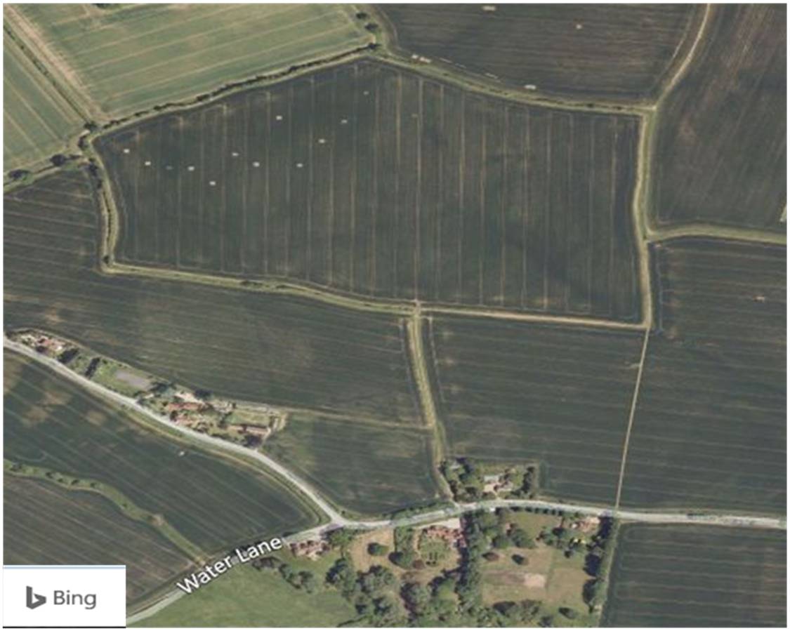
Maze Wood
Maze wood was an ancient woodland but was cut down and grubbed out in the 1960s. Alf Wright remembers explosives being used to blow up tree stumps! Woodland cannot be removed just by cutting down the trees. Stumps need to be removed so they do not re-grow, so this would have been a huge task. Why was this done, I wonder?
I would be very interested to hear from anyone about the end of Maze wood.
Maze wood – captioned ‘Maies woode’ – is shown on the Agas map of 1594 (below); note the distinctive shape of the area.
Agas map detail 1594.
Reproduced by courtesy of the Essex Record Office (Ref. ERO D/Dmg P25)
It is still there on the 1730 Easton Lodge Estate map, but now called ‘Mayes Wood’:
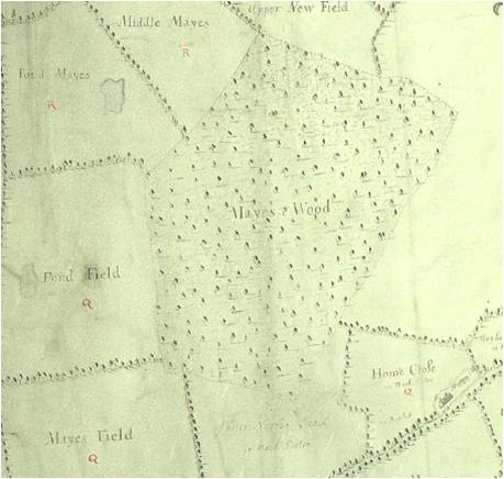
Easton Lodge Estate map detail.
Reproduced by courtesy of the Essex Record Office (Ref. ERO D/DMg P1/1)
It is not shown on the 1777 Chapman and Andre map, but is on the 1876 OS map, (now called ‘Maze wood’), and subsequent maps, and last appears on the 1955 OS map.
However, sometime in the 1960s it has gone. The distinctive outline survives to this day (below), but the trees are long gone and no part of the wood remains.
Report by Darren Stone ( email address: [email protected] ) — May 2017
NOTES
To anyone interested in forests and their history I cannot recommend enough two books by Oliver Rackham: ‘The History of the Countryside’, and ‘The Last Forest: The Story of Hatfield Forest’
Page last updated 30th June 2017